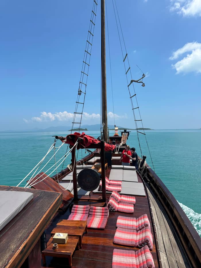
On your own
Rental scooter
Freedom, with real risk
See the optionsSpot your stop
See 20 route stops
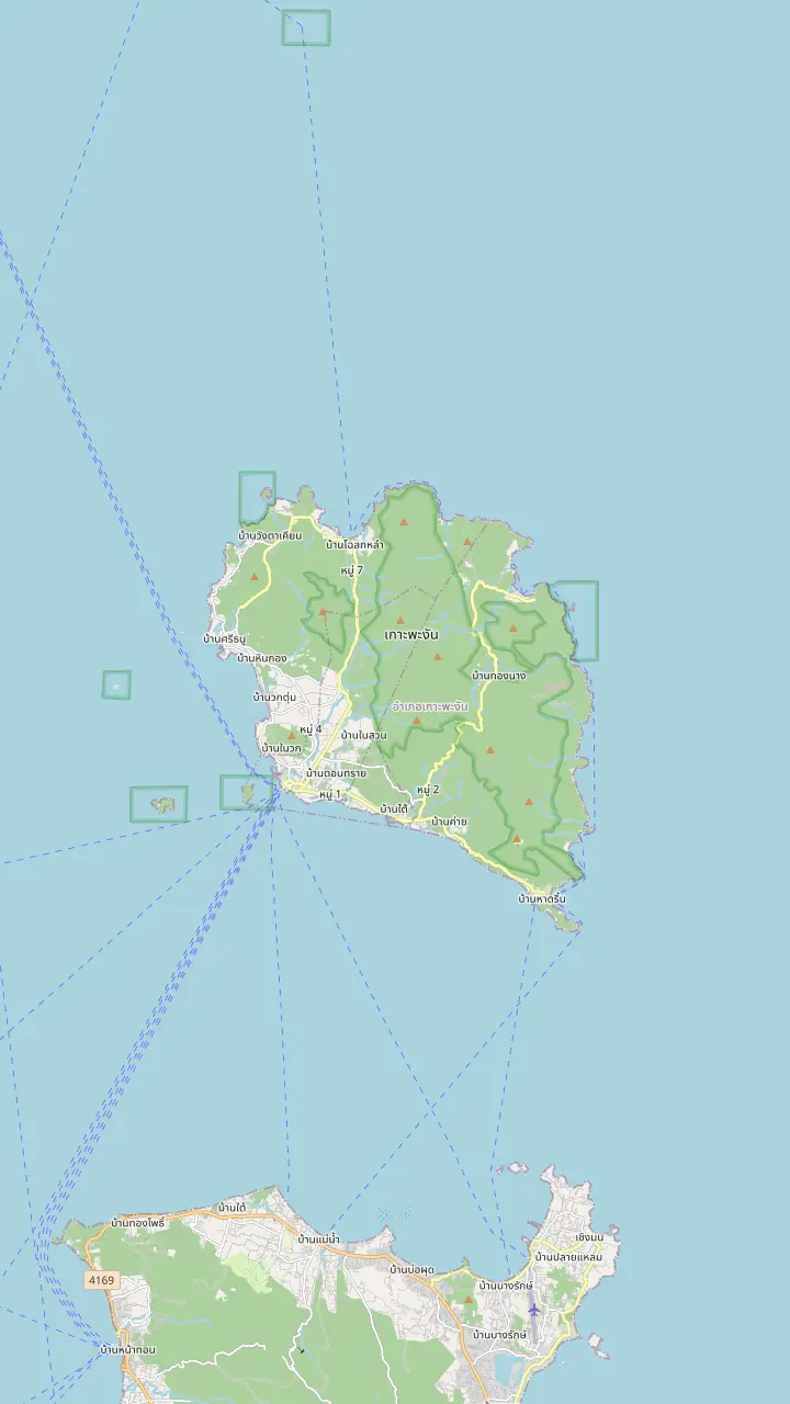
Pick a route and tap a pin or a stop: you get its note and a Google Maps link.
The main pier of the island, where the HMS Phangan Memorial Museum stands near the pier.
Google MapsAt Mae Hat a sandbar stretches to the island of Ko Ma.
Google MapsKo Ma has great snorkelling and a viewpoint for those who climb.
Google MapsOne of the west coast beaches named for sunsets.
Google MapsAnother west coast beach named for sunsets.
Google MapsA fishing village on the north coast, drawn here to place the north of the island.
Google MapsA north-east bay that the 4x4 road trips and the cruise's beach stop reach.
Google MapsHat Rin is named as the most famous beach of the island, where people like to party.
Google MapsA royal pavilion of King Rama V stands near this waterfall, one of three he named.
Google Maps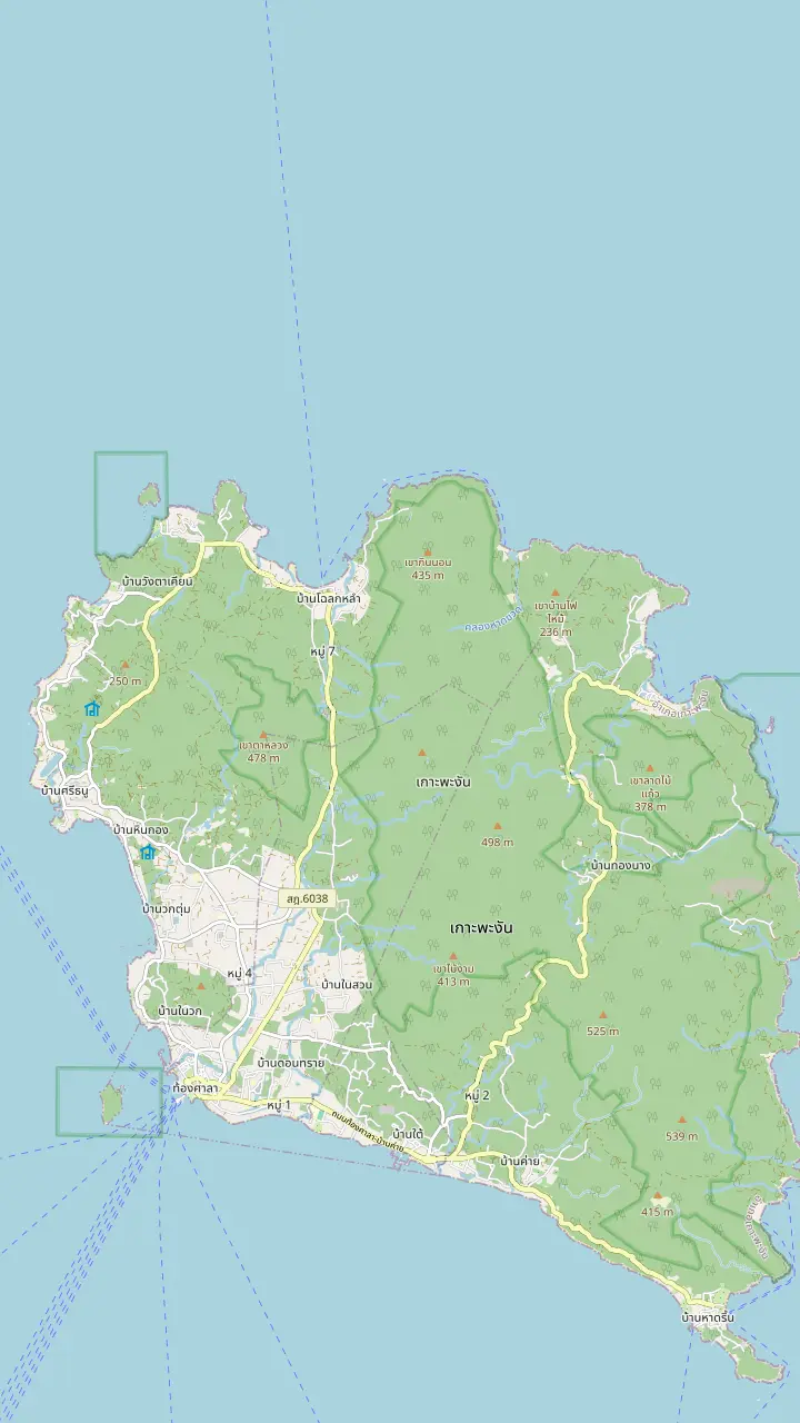
A royal pavilion of King Rama V stands near this waterfall, one of three he named.
Google MapsA waterfall in the south-west interior, drawn here to place the inland day.
Google MapsThe waterfall seen from the zipline on the north-west side of the island.
Google MapsA north-east bay that the 4x4 road trips and the cruise's beach stop reach.
Google MapsAt Mae Hat a sandbar stretches to the island of Ko Ma.
Google MapsKo Ma has great snorkelling and a viewpoint for those who climb.
Google Maps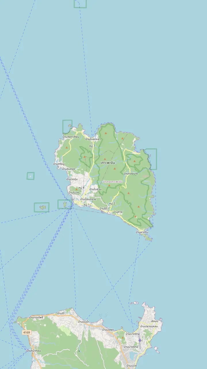
Hat Rin is named as the most famous beach of the island, where people like to party.
Google MapsThe main pier of the island, where the HMS Phangan Memorial Museum stands near the pier.
Google MapsOne of the west coast beaches named for sunsets.
Google MapsAnother west coast beach named for sunsets.
Google MapsAt Mae Hat a sandbar stretches to the island of Ko Ma.
Google MapsMap source: © OpenStreetMap contributors
Where is Koh Phangan, and what is on each coast? A plain-language map of the island between Samui and Koh Tao, with the piers, beaches, waterfalls, the roads between them and the history behind the names.
Editorial team, kohphangandaytrip.click · Updated November 12, 2026 · Reading: 7 min
Koh Phangan lies in the Gulf of Thailand, and the Tourism Authority of Thailand introduces it as the less famous sister island of Samui.1 It belongs to Surat Thani province, and TAT lists Ko Samui, Ko Pha-ngan and Ko Tao together when it reports on that province's destinations.2 On a map of the gulf you can picture a small chain of islands off the mainland coast, with Phangan in the middle and Ko Tao the farthest out.
The same TAT feature adds that the island has no airport, and it treats that as part of the attraction rather than a flaw.1 Getting there takes effort, and the reward, in its words, is an off-the-beaten-track feel.6 In practice that means a sea crossing: the boat services link Samui, Phangan and Ko Tao in a line, and TAT describes them as ferry connections between the three islands.7
If you are staying on Samui, Koh Phangan is a day away rather than a journey. The site's own cruise leaves from Koh Samui, sails to Koh Phangan after 11:00 AM and returns to the pier by 7:00 PM, which shows how close the two islands are in a day. Weather can reshape any sea day: TAT's December 2025 update reminded travellers to reconfirm ferry timings because marine transport may adjust to conditions.8
Island at a glance
| Place | Known for | Source note |
|---|---|---|
| Hat Rin | The party beach | Most famous beach18 |
| Hat Yao and Hat Salad | Sunsets | West coast beaches15 |
| Mae Hat and Ko Ma | Sandbar and snorkelling | Sandbar to Ko Ma16 |
| Thong Sala | Pier and museum | HMS Phangan museum4 |
| Than Sadet | Royal waterfalls | King Rama V pavilion10 |
| The interior | Jungle and trails | Over half is national park3 |
As the Tourism Authority of Thailand describes each place.18,15,16,4,10,3
Start on the west coast, where the sunsets are. For sunsets, the tourism authority points to Hat Yao, Hat Salad and little Ko Raham, where a quaint local restaurant serves sundowners and Thai dishes, so an evening here needs no more planning than a table facing the water.15 Mae Hat is also on this side, and there a sandbar stretches out to the island of Ko Ma. TAT adds that the little island is a good place to snorkel and has a viewpoint for those who climb.16,17
The south-east belongs to Hat Rin, where, in TAT's description, the island's best-known beach draws people who like to party.18 The same feature stresses that you do not have to join the party: it describes often-empty beaches, and says that those who explore find more tranquil stretches of sand.19 The north coast and its bays are quieter still, and the map above pins Chaloklum, Thong Nai Pan Yai and the Than Sadet waterfall so you can place them.
Behind the beaches the island rises into jungle, and the proportions are striking: TAT says over half of Koh Phangan's area is national park.3 That is why a drive across the interior feels so different from a day on the sand, and why the waterfalls, viewpoints and trekking routes are an island of their own. TAT also notes that adventure lovers can trek in the hills and go island hopping, which is how the sea and the land fit together here.20
Plan your hours
Listing durations: the ATV day runs 1.5 to 4.5 hours and the zipline visit 30 minutes to 1 hour, so the longest figure is shown.
Thong Sala Pier is the place on the map to anchor yourself, and for any Koh Phangan travel guide it is the natural starting point. Close to it TAT places the HMS Phangan Memorial Museum, a shipboard museum where the island's history is told in an exhibition called Island of Kings.4 It is an easy stop when you step off a boat, and the Colourmoon Festival grounds beside it show how the pier area doubles as a gathering place for the island.
TAT also describes fishing villages around the island where locals keep a traditional way of life, a useful reminder that Phangan is a place where people live and work, not only a stop on a travel route.26 A statue of King Rama V stands at Thongsala Beach, a mark of how long the island has been visited and loved.12 The map pins give you the bearings: Thong Sala on the west, Haad Rin in the south-east, and Chaloklum looking north across the water.
If you want to place a name quickly, work from the pier and use the map above. Head north along the west coast and you reach Haad Yao, Haad Salad and Mae Haad, with Ko Ma just offshore. Turn inland and you climb towards the waterfalls and, beyond them, the north-east bays of Thong Nai Pan. Haad Rin sits apart in the south-east, so it is best treated as its own destination whenever you plan a day around it.
Pick your way
Link the sort of day you are planning to a way of getting about, using what the official advice and the listings say.
If I want a day with no driving
Book a shared road trip
Pickup is included and the stops are planned.
If I travel with my own group
Book the private road trip
The same stops by SUV for a private group.
If I want a scooter
Check the paperwork first
Hire bikes are often unregistered.5
If I have no motorcycle licence
Do not ride
Riding unlicensed may void insurance.24
If I want sunsets and no planning
Head to the west coast
Hat Yao and Hat Salad are named for sunsets.15
Ways around
On your own
Freedom, with real risk
See the options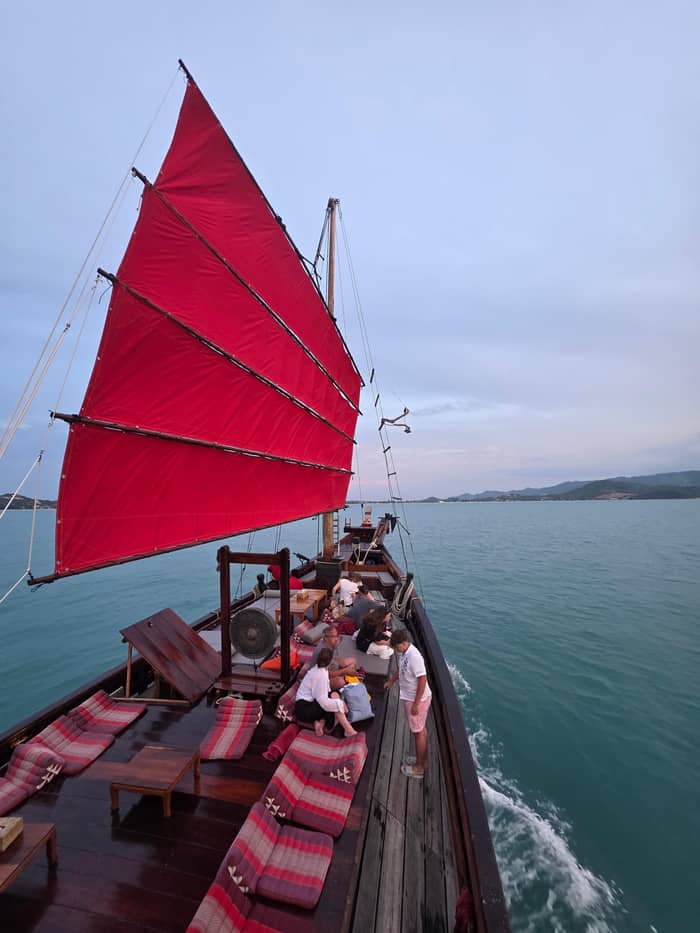
Easy day
A guide and a 4x4
Own group
Your group, your pace
Anyone asking how to get around Koh Phangan will find there is no single way to move around the island, and the sensible choice depends on the risk, effort and planning you are willing to take on, so compare the options honestly before you arrive. Guided road trips are the easy option: a shared 4x4 day on Koh Phangan lasts 7 hours, includes pickup and stops at the Than Sadet waterfall, Thong Nai Pan Yai and either Haad Yao or Haad Rin, plus a snorkelling stop at Koh Ma.
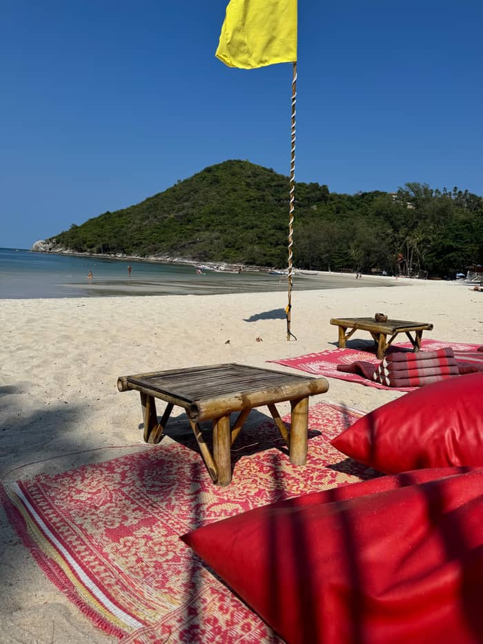
A private-group version covers the same stops by air-conditioned SUV, also in 7 hours, if you prefer your own pace and your own companions in the car. Both listings let you cancel free up to 24 hours ahead. A longer ATV or jungle day is a different kind of trip, and the jungle page of this guide covers those; here the point is simply that a guide turns a hard-to-read road map into a day with a plan and a driver.
Independent travel is possible too, and TAT's driving advice for Thailand is a good place to start: drive on the left, and ride only with a helmet on, passengers included.30,29 Hiring a car or motorbike means producing a valid driving licence or an International Driving Permit, and reputable companies will ask to see it.22 Whatever you choose, save Thailand's emergency numbers on your phone: medical emergencies go to 1669 and the police to 191.31
Price a guided day
Set your group size and see what a guided day on the island costs.
Weigh up 3 options
Set your group size and see what a guided day on the island costs.
≈
View≈
View≈
ViewFigures are GetYourGuide from-prices, translated at the ECB reference rate. The booking step shows what you pay exactly.
Royal island
Royal holidays
He spent holidays on the island 14 times between 1888 and 1909.9
Waterfall names
Thansadet, Thanprapas and Thanprawet.10
Carved stones
Royal initials on 5 stones near the falls.11
Beach statue
King Rama V is remembered on the beach.12
Dry dock
A permanent exhibition since 2015.13
Every April
The coconut crop is celebrated.14
Many travellers picture a scooter as the natural way to see an island, so it is worth reading what governments say before you decide. Rental bikes are the first worry in the UK government's advice: those on offer in tourist areas are often unregistered, which means they are not legal to ride on a public road.5 It also notes that the World Health Organisation ranks Thailand among the world's deadliest countries for motorcycle fatalities.32
Canada goes further and advises avoiding driving or riding motorcycles in Thailand at all, even for experienced riders, adding that rental scooters are often poorly maintained.33,34 Both governments agree on helmets, and Canada warns that many do not meet international safety standards, so a good helmet of your own is worth thinking about.21,35 None of this says you cannot hire a scooter, but it does mean the decision should be made with open eyes.
If you do rent, protect yourself on paper as well as on the road. Photograph any existing damage before you leave, read the contract for insurance against damage and theft, and never hand over your passport as a guarantee.23,27,28 A riding licence matters too: the UK warns that riding without a valid licence could invalidate your travel insurance.24 TAT adds that without proper documents insurance may be void after an accident.36
Video
Experience Luxury Travel on YouTube · Video data is requested only when you tap play.
While the island is most famous internationally for its Full Moon parties, there is so much more to explore here
Before you move
Koh Phangan history is easiest to tell through a king: anyone searching for the island's past soon meets him. TAT says King Rama V the Great spent holidays on Koh Phangan 14 times, plus two stopovers, between 1888 and 1909.9 Near Thansadet Waterfall you can still see his royal pavilion and the three waterfalls he named Thansadet, Thanprapas and Thanprawet, and TAT adds that he inscribed his royal initials on 5 stones nearby as memoirs of his visits.10,11
Away from royal history, TAT describes an island whose local way of life surrounds the coconut and squid fishing industries, which is the working story behind the postcard beaches.37 Coconut palms are vital to the island's economy, and every April a Colourmoon Festival celebrates the crop.38,14 The festival's 2017 theme was Coconut is Life, a showcase for the island's coconuts used in crafts, cooking and even clothes.39
The modern chapter is the one the world knows. TAT says the island is recognised for its white sandy beaches, crystal clear sea, the famous full moon party and its yoga teacher training.40 The Royal Navy ship that has sat in dry dock at Thongsala since 2015 holds a permanent exhibition on the island's royal connections, so the royal past and the lively present now sit side by side near the pier.13
FAQ
TAT names Hat Rin as the island's most famous beach, where people like to party.18
TAT says over half of the island's area is national park.3
TAT recommends Hat Yao, Hat Salad and Ko Raham for sunsets.15
Sources
Planning Phangan from Samui? A real person answers here.